Navigate Caborca
Navigating the streets, avenues and highways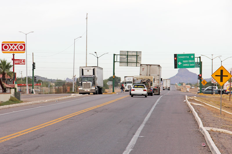
Navigating the Streets and Highways of Caborca
Caborca’s Main Highways
Federal Highway 2
Caborca is situated on Mexico federal highway 2 (also known locally as the carretera internacional, or the international highway), which passes to the east and north of Caborca. Mexico highway 2 extends from the town of Santa Ana, Sonora, passing through Altar and Caborca, and continuing on to the Arizona-Sonora border crossing of Sonoyta, Sonora and Lukeville, Arizona, as well as continuing west to destinations like Mexicali, B.C. and ultimately ending at the city of Tijuana, Baja California.
The main streets and avenues in Caborca that intersect with highway 2 (from south to north) are Calle 5 (Calle Obregon), Calle 8, Avenida Quiroz y Mora, and Avenida H. Colegio Militar.
The city is also at a junction of Mexico highway 2 and state road 044, a popular road for beachgoers who are traveling from the east (such as south from Nogales and west from Santa Ana) to destinations along the Sea of Cortez like El Desemboque, Puerto Lobos and Puerto Libertad.
State Highway 37
Highway 37 splits from highway 02 in eastern Caborca, and as it passes through Caborca it is also known as Calle Obregon, or 5th Street, the main east-west (albeit mainly one-way to the west) thoroughfare in Caborca.
In leaving Caborca, highway 37 passes by the Caborca airport (a small airstrip with some crop dusters and small private planes) and the tourist attractions of Rancho Puerto Blanco (La Proveedora, with the largest concentration of petroglyphs in Latin America) and the roadside shrine to the Virgin Mary of Guadalupe.
After passing through Caborca, the highway continues past ejidos, open desert, grape vineyards, asparagus fields and olive groves for about 60 miles, until it forks at a pueblo called La Igriega (which literally means “the Y,” to describe the intersection).
Take a right at the fork in the road in La Igriega and you’ll continue on northward to Rocky Point. A left turn and you’ll be heading toward the new coastal highway and destinations like El Desemboque, Puerto Lobos and Puerto Libertad.
Navigating Street Addresses in Caborca
Caborca is basically a grid of streets (calles) that run from east to west and intersect with avenues (avenidas) that are oriented from north to south. Most of the calles are numbered, and most of the avenues are named.
Street addresses use building numbers (like “110 Calle Obregon”), but addresses are usually provided by giving the name of the street (or avenue) and listing the avenues (or streets) it is located between. For example, Vero’s Hamburgers and Sandwiches is located on Calle 10, between Avenues N and O (entre avenidas N y O).
To read more about navigating the streets and avenues of Caborca, click on a link below:
Navigating the streets of Caborca